Executive Archaeological Dispatch & Historical Coordinates
Rediscovery Date: July 24, 1911 | Geographical Coordinates: 13°09′47″ S, 72°32′44″ W | Elevation: 7,970 ft (2,430 m) above sea level | Expedition Leader: Hiram Bingham III (Yale University & National Geographic Society) | Key Local Guides: Melchor Arteaga (local Quechua farmer) & Pablito Alvarez (11-year-old boy) | True Historical Identity: Royal estate and ceremonial sanctuary of Sapa Inca Pachacuti (c. 1450 CE), not the lost capital of Vilcabamba.
On the morning of July 24, 1911, an obscure thirty-five-year-old assistant professor of Latin American history at Yale University named Hiram Bingham III scrambled on hands and knees through dense, viper-infested cloud forest high above the roaring Urubamba River in the Peruvian Andes. Drenched in cold drizzle, Bingham was searching for Vilcabamba—the fabled “Lost City of the Incas,” the jungle stronghold where the rebellious young Inca ruler Manco Inca had waged a thirty-six-year guerrilla insurgency against the Spanish conquistadors following the 1533 fall of Cusco.
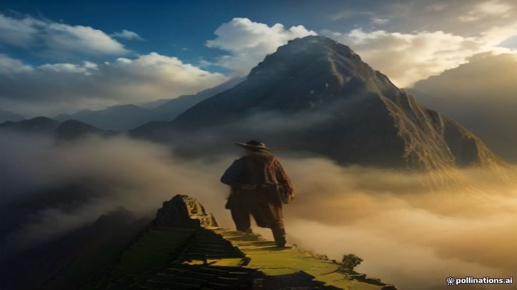
Instead, emerging from the tangled jungle undergrowth onto a narrow granite ridge suspended between the towering peaks of Huayna Picchu and Machu Picchu, Bingham stumbled upon what is now recognized as the architectural crown jewel of pre-Columbian America. Hidden beneath centuries of hanging vines, bamboo, and moss lay terraces of white granite masonry fitted together with such astonishing precision that not even a knife blade could be slipped between the mortarless stones. Bingham had inadvertently uncovered Machu Picchu.
The Historical Context: The Rise of Pachacuti’s Royal Estate
Unlike European conquerors who assumed Machu Picchu was an ancient fortress or mystical temple of the Sun Virgins, modern archaeological research by John Rowe and Richard Burger has established its true historical provenance. Built around 1450 CE at the height of the Inca Empire (Tawantinsuyu), Machu Picchu was commissioned by the empire’s greatest visionary ruler: Pachacuti Inca Yupanqui (the “Transformer of the Earth”).
Machu Picchu functioned as a luxurious royal estate (hacienda) and ceremonial citadel. Situated in the subtropical cloud forest zone known as the Ceja de Selva (“eyebrow of the jungle”), it served as an elite winter retreat for Pachacuti and his royal lineage (panaca), offering an agreeable temperate climate away from the freezing winter winds of Cusco. The site hosted approximately 750 resident elites, priests, astronomers, and specialized artisans (yanacona) who cultivated terraced maize, sacred coca leaves, and medicinal rainforest herbs.
Inca Architectural and Civil Engineering Mastery
The survival of Machu Picchu over five centuries of seismic volatility in an earthquake-prone zone is a testament to the greatest civil engineering minds in antiquity. Over sixty percent of the construction effort at Machu Picchu took place entirely underground:
1. Drainage and Hydrological Architecture
The ridge receives over seventy inches of torrential rainfall annually. Without sophisticated drainage, the entire citadel would have long ago collapsed down the precipitous 1,500-foot granite cliffs into the Urubamba River. Inca engineers constructed over 129 subterranean drainage outlets and layered the agricultural terraces with deep beds of crushed rock, gravel, and topsoil that filtered rainwater away from building foundations.
Furthermore, they engineered a stone aqueduct that channeled water from a natural mountain spring across 2,400 feet into a series of sixteen cascading granite fountains, ensuring a continuous supply of clean drinking water to the royal residences.
2. Ashlar Masonry and Seismic Engineering
Inca stonemasons utilized ashlar masonry, shaping multi-ton blocks of locally quarried white granite without iron tools, relying on harder stone hammerstones (hematite and basalt), bronze chisels, and wet sand abrasives. Each block was carved with interlocking joints, bevelled edges, and interior peg-and-socket configurations.
During earthquakes, these dry-stone walls do not crack; instead, the stones “dance”—shifting slightly to dissipate seismic energy before settling back into their exact original positions. Windows and doorways were built with inward-slanting trapezoidal geometries, providing structural triangular strength against lateral ground tremors.
The 1911 Yale Peruvian Expedition
Hiram Bingham was not a trained field archaeologist, but an ambitious adventurer whose marriage to Alfreda Mitchell (heiress to the Tiffany & Co. fortune) provided the social capital needed to fund his wanderlust. In 1911, backed by Yale University and the National Geographic Society, Bingham assembled an interdisciplinary expedition of surveyors, cartographers, and surgeons to map the Urubamba canyon.
The Discovery at the Mandor Pampa
On July 23, 1911, while encamped at the Mandor Pampa along the newly blasted railway road beside the Urubamba River, Bingham met a local Quechua-speaking farmer named Melchor Arteaga. Over a payment of a silver coin (fifty centavos), Arteaga casually mentioned that high on the mountain ridge above his farm sat ancient stone ruins called Machu Picchu (“Old Peak” in Quechua).
The following morning, July 24, while his companions chose to stay in camp washing clothes, Bingham crossed the raging Urubamba on a precarious footbridge fashioned from four half-rotten logs lashed with vines. Accompanied only by Arteaga and a Peruvian police sergeant, Sergeant Carrasco, Bingham climbed 2,000 vertical feet through thorny bamboo thickets.
Near the summit, they reached a thatched hut where two Quechua farmers, Richarte and Alvarez, had cleared several ancient terraces to grow crops. The farmers sent an eleven-year-old boy, Pablito Alvarez, to guide the American stranger up into the ruins. Stepping through a dense thicket of trees, Bingham was stunned into speechlessness:
“Suddenly I found myself confronted with the walls of ruined houses built of the finest quality of Inca stonework. The sight held me spellbound… Would anyone believe what I had found? I could scarcely believe my eyes.”
Key Structures of the Sacred City
Over subsequent expeditions in 1912 and 1915, Bingham cleared the thick jungle canopy, surveying and naming the major architectural complexes that define Machu Picchu today:
The Intihuatana Stone (“The Hitching Post of the Sun”)
Perched upon the highest granite knoll in the sacred sector stands the Intihuatana: an elegant astronomical monolith carved directly out of the living bedrock. Used by Inca solar priests, the vertical stone gnomon served as an astronomical calendar. During the winter solstice (Inti Raymi) in June and the spring equinox, the shadow cast by the sun indicated the precise moment when the sun appeared to “tie itself” to the rock, reassuring the populace that the solar deity would not abandon the earth.
The Temple of the Sun (Torreón)
A semi-circular stone tower displaying the finest curved ashlar masonry in the Americas, built atop an enormous natural granite boulder containing a subterranean royal tomb. The temple’s trapezoidal window is oriented with astronomical precision to allow the rays of the rising sun on the winter solstice to illuminate an interior carved altar stone.
The Temple of the Three Windows
An imposing stone hall overlooking the central plaza, featuring three colossal trapezoidal windows. Bingham believed the three apertures symbolized the mythological cave of Tambotoco, from which the four legendary Ayar brothers emerged to establish the Inca civilization.
Chronological Timeline of the Machu Picchu Rediscovery
| Date | Key Historical Figure | Historical & Archaeological Event |
|---|---|---|
| c. 1450 CE | Sapa Inca Pachacuti | Construction of Machu Picchu as a royal estate and ceremonial center. |
| c. 1536 – 1572 CE | Inca Retainers | Citadel abandoned following Spanish conquest; Spanish never locate the site. |
| July 14, 1902 | Agustín Lizárraga | Local Peruvian farmer visits ruins, carving his name and date on the Temple of the Three Windows. |
| July 24, 1911 | Hiram Bingham III | Bingham guided to ruins by Melchor Arteaga and Pablito Alvarez; scientific documentation begins. |
| April 1913 | National Geographic | Devotes entire monthly issue to Machu Picchu, launching global international fame. |
| 1983 CE | UNESCO | Machu Picchu officially inscribed as a UNESCO World Heritage Site. |
| 2011 – 2012 CE | Yale University & Peru | Yale University repatriates over 46,000 artifacts excavated by Bingham to Cusco. |
Bingham’s Historical Error and the Repatriation Battle
Despite his brilliant discovery, Hiram Bingham lived and died under a profound geographical misconception. Until his death in 1956, Bingham insisted that Machu Picchu was Vilcabamba, the lost rebel capital where Manco Inca had fought the Spanish, and the birthplace of the Inca dynasty. It was not until the 1960s, through the investigations of American explorer Gene Savoy at Espíritu Pampa, that the true ruins of Vilcabamba were located deep in the Amazonian lowlands.
Furthermore, Bingham was not the first non-Inca to set eyes on the ruins. On the granite wall of the Temple of the Three Windows, Bingham himself noted charcoal graffiti left in 1902 by a local Peruvian farmer named Agustín Lizárraga. What Bingham provided was not literal discovery, but systematic scientific documentation, global publication, and cartographic preservation.
The expedition also sparked a bitter century-long diplomatic controversy. Between 1912 and 1915, Bingham shipped over 46,000 artifacts—including mummified skeletons, bronze tools, ceramic vessels, and silver pins—to the Peabody Museum of Natural History at Yale University under a temporary governmental loan. For decades, Peru demanded their return. Finally, following a fierce legal battle and direct intervention by the Peruvian presidency, Yale signed an accord in 2010, fully repatriating the entire collection to the Casa Concha Museum in Cusco in 2011—exactly one century after Bingham’s fateful climb.
Key Archival Takeaways
- Royal Estate Reality: Built by Emperor Pachacuti c. 1450 CE as a subtropical palace retreat, not a defensive military fortress.
- Subterranean Civil Engineering: Over 60% of construction was devoted to underground gravel drainage networks, preserving the granite citadel from catastrophic landslide erosion.
- Ethical Repatriation: Highlighted modern archaeological ethics, culminating in the 2011 repatriation of 46,000 artifacts from Yale University back to Peru.
Frequently Asked Questions (FAQ)
Why didn’t the Spanish conquistadors destroy Machu Picchu?
The Spanish conquistadors never found Machu Picchu. Situated high on an isolated ridge above a dense, vertical gorge, the site had no strategic military significance. When the Inca empire collapsed from smallpox and civil war in the 1530s, the royal retainers abandoned the estate, and the rapidly growing cloud forest canopy enveloped the white granite walls, hiding them from Spanish patrols for 375 years.
Did Hiram Bingham inspire the character of Indiana Jones?
Yes, in part. Bingham’s iconic photograph wearing a wide-brimmed felt fedora, khaki safari jacket, and carrying a walking staff while exploring Peruvian ruins served as a major visual template for George Lucas and Steven Spielberg when creating the character of Indiana Jones in Raiders of the Lost Ark.
What does “Machu Picchu” and “Huayna Picchu” mean?
In the Quechua language of the Incas, Machu Picchu translates to “Old Peak” or “Old Mountain,” while the iconic, steep peak rising directly behind the ruins, Huayna Picchu (or Wayna Picchu), translates to “Young Peak.”