DEEP OCEAN RESEARCH STATION · MARINE SCIENCE
Mapping the Hidden Mountains and Valleys Beneath the Sea.
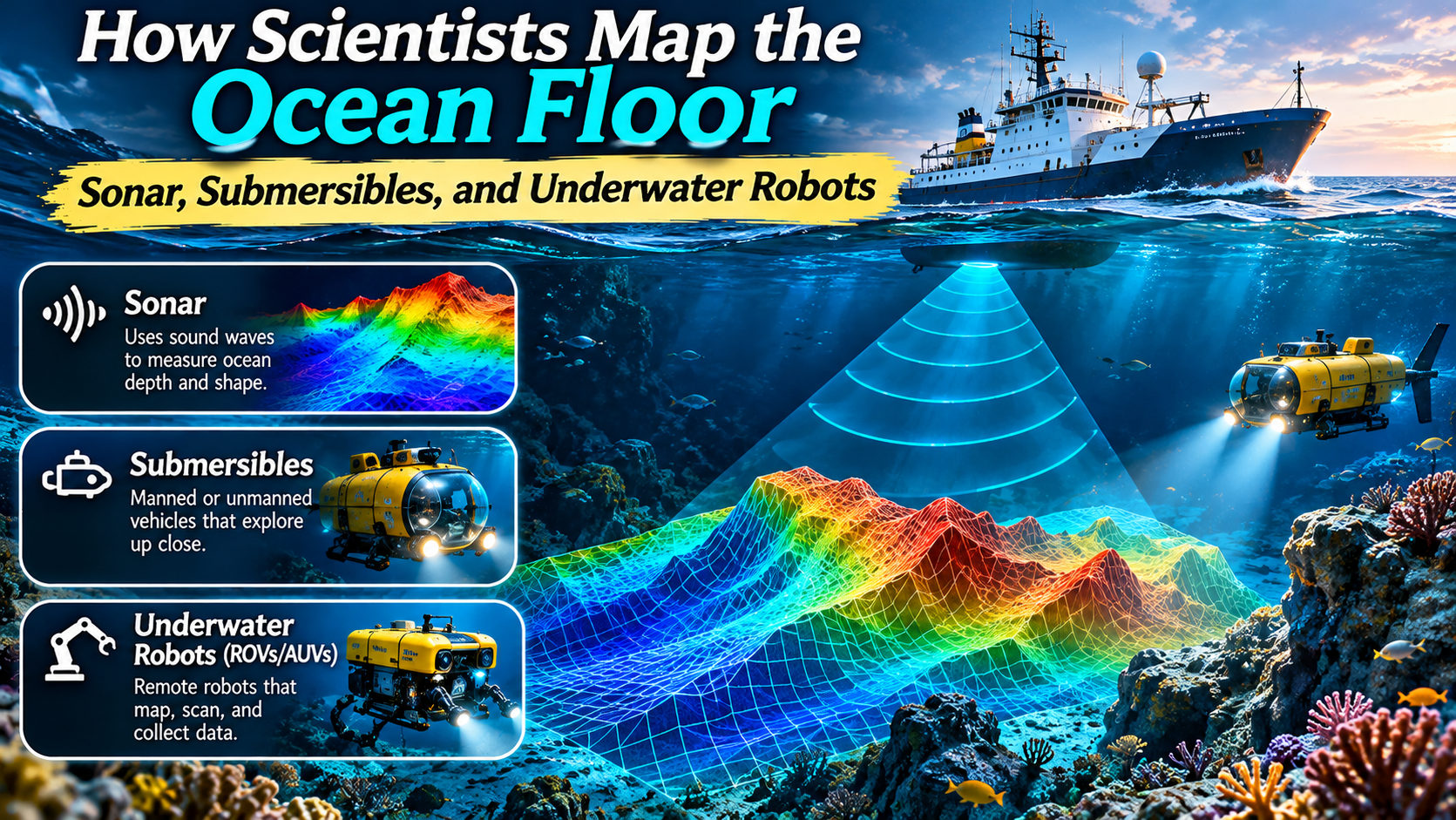
Discover how scientists use sound waves, research vessels, crewed submersibles, and underwater robots to reveal the shape of the ocean floor.
📡
SONAR
SOUND MAPPING
🚢
SUBMERSIBLES
DIRECT EXPLORATION
🤖
ROBOTICS
AUTONOMOUS SURVEYS
Far beneath the ocean surface lies a landscape of mountains, valleys, plains, volcanic ridges, and deep trenches.
Some underwater mountains rise thousands of meters above the surrounding seafloor. Other regions contain broad, relatively flat abyssal plains or narrow channels shaped by sediment movement.
These features are difficult to observe directly because seawater blocks much of the light needed for conventional imaging.
Unlike mapping land from aircraft or satellites, mapping the deep ocean floor requires specialized techniques that can work through enormous depths of water.
Scientists use sound waves, satellite measurements, research vessels, crewed submersibles, and underwater robots to investigate these hidden environments.
Each technology provides different information. Sonar measures water depth and seafloor shape, while cameras, sensors, and sampling equipment help researchers examine geological features and marine habitats.
Together, these methods are transforming our understanding of the ocean floor.
This guide explains how ocean-floor mapping works, why different technologies are necessary, and how the resulting maps support science, navigation, conservation, and hazard research.
What Is Ocean-Floor Mapping?
Ocean-floor mapping is the process of measuring and representing the physical features of the seabed.
One of its most important components is bathymetry, which describes underwater depth and terrain.
Bathymetric maps show features such as continental shelves, submarine canyons, seamounts, ocean ridges, and deep trenches.
These maps are similar in purpose to topographic maps used on land.
However, instead of showing elevation above sea level, bathymetric maps commonly represent water depth below a reference surface.
Scientists use bathymetric information to understand seafloor geology, identify potential habitats, study ocean circulation, and improve marine navigation.
MARINE SCIENCE PRINCIPLE
Bathymetry reveals the shape of the underwater landscape.
Depth measurements allow researchers to construct maps of the seabed, but additional observations are often needed to determine what the seafloor is made of and which organisms live there.
1. Why the Ocean Floor Is Difficult to Map
The ocean covers most of Earth’s surface, but mapping the deep seafloor presents major technical challenges.
Water absorbs and scatters electromagnetic radiation, limiting how far ordinary visible-light cameras can see.
In deep water, sunlight is absent, so underwater vehicles require artificial lighting for visual observations.
High water pressure also creates demanding engineering conditions.
Equipment operating at great depths must be designed to withstand pressure, corrosion, and difficult communication environments.
Another challenge is the enormous area that must be surveyed.
Research vessels can collect detailed measurements, but surveying large ocean regions takes time and resources.
These limitations explain why scientists use several complementary mapping technologies rather than relying on one method.
2. How Sonar Maps the Seafloor
MAPPING TECHNOLOGY 01 · ACOUSTICS
Using Sound to Measure the Deep
Sonar systems transmit sound pulses through water and analyze returning echoes to estimate distances, identify objects, and characterize underwater terrain.
Sonar stands for Sound Navigation and Ranging.
It is one of the most important technologies used in ocean-floor mapping.
Sound travels efficiently through seawater compared with visible light, making acoustic methods especially useful in deep or turbid environments.
A sonar system sends a sound pulse toward the seabed.
When the pulse encounters the bottom, some sound energy reflects back toward the receiver.
By measuring the travel time and accounting for the speed of sound in water, the system can estimate the distance to the seafloor.
Why Sound Speed Matters
The speed of sound in seawater varies with temperature, salinity, and pressure.
Scientists measure or estimate these conditions so sonar data can be corrected accurately.
Without suitable corrections, calculated depths and the positions of mapped features may contain errors.
3. Single-Beam and Multibeam Echo Sounders
Different sonar systems collect depth information in different ways.
Single-Beam Echo Sounders
A single-beam echo sounder measures depth primarily beneath the vessel.
As a ship moves, the system collects depth measurements along its track.
This method has long been used in hydrographic surveying and navigation.
However, it provides limited coverage of the seabed between survey lines.
Multibeam Echo Sounders
Multibeam sonar systems transmit and receive sound across a broad swath beneath and to the sides of a vessel.
They collect many depth measurements across that swath.
As the vessel moves, overlapping survey lines can produce detailed three-dimensional representations of the seafloor.
Multibeam data may reveal submarine canyons, volcanic structures, landslide scars, and other features.
The level of detail depends on factors including water depth, equipment characteristics, survey design, and data processing.
HOW MULTIBEAM MAPPING WORKS
↓
↓
↓
↓
This diagram simplifies the process. Real surveys also require positioning, sound-speed corrections, vessel-motion compensation, and data quality control.
4. What Is Side-Scan Sonar?
Side-scan sonar is another important acoustic technology used to examine the seafloor.
Rather than primarily producing depth measurements, side-scan sonar creates images based on the strength and pattern of sound reflected from underwater surfaces.
These images can reveal differences in seabed texture and identify objects such as rocks, shipwrecks, or debris.
Side-scan sonar is useful for seafloor habitat studies, archaeological surveys, and object detection.
However, conventional side-scan imagery does not provide the same direct bathymetric measurements as a multibeam echo sounder.
Scientists often combine acoustic imagery with depth data and direct observations to interpret underwater features more accurately.
5. How Satellites Help Estimate Ocean-Floor Features
Satellites can contribute to seafloor mapping even though they cannot directly photograph most of the deep seabed.
Large underwater mountains and trenches influence Earth’s gravitational field.
These gravitational variations can create subtle changes in the height of the ocean surface.
Satellite radar altimeters measure sea-surface height with great precision.
Scientists analyze these measurements, along with other information, to infer broad features of the seafloor.
This method is often called satellite-derived bathymetry from gravity.
It is especially useful for identifying large-scale structures in regions without detailed ship-based surveys.
However, these estimates are generally less detailed than modern direct acoustic surveys.
In shallow, clear coastal waters, satellite imagery can also support bathymetric estimation using the way light interacts with water and the seabed.
That optical approach is different from gravity-based mapping of the deep ocean.
6. Crewed Submersibles: Exploring the Seafloor Directly
EXPLORATION TECHNOLOGY 02 · CREWED VEHICLES
Human Observation in the Deep Ocean
Crewed submersibles carry trained occupants underwater, allowing direct observation and specialized scientific investigation in environments that are otherwise difficult to access.
Some scientific missions use crewed submersibles to examine underwater environments.
These vehicles may contain observation windows, cameras, lights, sensors, and sampling equipment.
Researchers can investigate geological formations, marine organisms, and other features directly.
However, crewed submersibles are not typically the primary tool for mapping enormous areas of the seafloor.
Their greatest value often lies in focused observations and sampling at selected locations.
Operating at great depths requires specialized engineering, safety procedures, and support systems.
7. Remotely Operated Vehicles: Robots Controlled From the Surface
EXPLORATION TECHNOLOGY 03 · ROV SYSTEMS
Underwater Robots With Human Operators
Remotely operated vehicles, or ROVs, are underwater robots controlled by operators, typically through a cable connection to a surface vessel.
ROVs allow researchers to investigate underwater environments without sending people to the seafloor.
Many scientific ROVs carry high-definition cameras, lights, sonar, environmental sensors, and robotic manipulators.
Operators can use these systems to inspect geological formations, document marine life, and collect selected samples.
ROVs are especially valuable when precise maneuvering and real-time human decisions are important.
However, the tether and support vessel can limit how the vehicle moves and where it operates.
8. Autonomous Underwater Vehicles: Robots That Survey Independently
EXPLORATION TECHNOLOGY 04 · AUV SYSTEMS
Robotic Mapping Without a Continuous Tether
Autonomous underwater vehicles, or AUVs, follow programmed missions and use onboard systems to navigate, collect data, and survey underwater environments.
AUVs are important tools for modern marine research.
Unlike most ROVs, AUVs do not require a continuous control tether to a surface vessel.
They can follow planned survey routes while collecting sonar measurements and environmental data.
Some AUVs operate relatively close to the seabed, allowing high-resolution surveys of selected areas.
Others are designed for broader oceanographic missions.
Autonomous navigation is challenging underwater because conventional satellite positioning signals do not travel effectively through seawater.
AUVs may use inertial navigation, acoustic positioning, Doppler velocity measurements, and other systems to estimate their location.
After completing a mission, the vehicle may return to the surface or a recovery location so researchers can retrieve the data.
ROVs vs. AUVs vs. Crewed Submersibles
| Feature | ROV | AUV | Crewed Submersible |
|---|---|---|---|
| Control | Remote human operator | Onboard autonomous systems | Human occupants |
| Tether | Usually required | Generally untethered | Usually untethered |
| Typical Strength | Detailed inspection and sampling | Planned autonomous surveys | Direct human observation |
| Common Equipment | Cameras, manipulators, sensors | Sonar, navigation sensors, cameras | Viewing systems, sensors, sampling tools |
| Main Limitation | Tether and support requirements | Battery, navigation, and mission constraints | High operational complexity and safety requirements |
The best technology depends on the scientific question, water depth, terrain, required resolution, and available resources.
9. What Scientists Discover Through Seafloor Mapping
Detailed ocean-floor maps reveal features that help researchers understand Earth’s geology and marine environments.
Mid-Ocean Ridges
Mid-ocean ridges are extensive underwater mountain systems associated with tectonic plate boundaries.
They are important locations for studying seafloor spreading and volcanic activity.
Ocean Trenches
Ocean trenches are deep, elongated depressions commonly associated with subduction zones.
They provide opportunities to investigate tectonic processes and deep-sea environments.
Seamounts
Seamounts are underwater mountains that rise above the surrounding seafloor.
Many are volcanic in origin.
They can influence ocean currents and provide habitats for marine organisms.
Submarine Canyons
Submarine canyons are valleys cut into the seafloor, often along continental margins.
They can transport sediment and influence the movement of water and nutrients.
Hydrothermal Vent Areas
Hydrothermal vents occur where geologically heated fluids emerge from the seafloor.
These environments can support unusual ecosystems based on chemical energy rather than sunlight.
Mapping helps researchers identify geological structures associated with potential vent activity, while direct observations are usually needed to confirm specific vent sites.
10. How Raw Sonar Measurements Become Detailed Maps
Collecting sonar data is only the beginning of the mapping process.
Researchers must process the measurements to produce reliable maps.
Modern surveys use positioning systems, vessel-motion sensors, and measurements of sound speed in seawater.
These data help correct for factors such as ship movement, changing water conditions, and acoustic measurement geometry.
Scientists then identify and remove unreliable measurements where appropriate.
Validated depth points can be combined into digital terrain models.
These models represent the shape of the seafloor and can be displayed using shaded relief, depth colors, or contour lines.
The final map may be integrated with geological samples, underwater photographs, and environmental observations.
11. Why Seafloor Maps Matter for Marine Navigation
Accurate depth information is essential for safe marine navigation.
Hydrographic surveys help identify underwater hazards and support the production of nautical charts.
However, scientific bathymetric maps and official navigation charts serve different purposes.
Navigation charts require appropriate standards, reference systems, quality controls, and updates.
Mariners should rely on official, current navigational information rather than treating an exploratory research map as a substitute.
12. Ocean-Floor Mapping and Natural Hazards
Seafloor mapping supports research into underwater earthquakes, submarine landslides, volcanic activity, and tsunami-related processes.
Detailed maps can reveal fault-related structures, slope failures, and sediment deposits.
These observations help scientists understand geological processes and improve hazard models.
However, mapping a fault or submarine landslide does not mean researchers can predict the exact time of a future earthquake or tsunami.
Bathymetry is one important component of broader geophysical research and risk assessment.
13. How Mapping Supports Deep-Sea Conservation
The shape and composition of the seafloor influence marine habitats.
Rocky ridges, sediment plains, underwater canyons, and seamounts can support different biological communities.
Detailed mapping helps researchers identify habitat features and select locations for scientific observations.
Combining bathymetry with imagery, biological sampling, and environmental measurements can improve habitat assessments.
This information can support marine conservation planning and the evaluation of potential human impacts.
However, terrain alone does not establish which species are present or whether an area requires protection.
Biological evidence and ecological context remain essential.
14. The Future of Ocean-Floor Mapping
Ocean-floor mapping technology continues to develop.
Improvements in sonar systems, underwater navigation, robotics, and data processing may make surveys more efficient.
Autonomous surface vessels can also carry mapping equipment in suitable conditions.
Some research efforts explore how machine learning can assist with processing sonar data, identifying patterns, and detecting potential anomalies.
However, automated systems still require careful validation and scientific oversight.
International initiatives such as Seabed 2030 encourage the collection and sharing of bathymetric data to improve global knowledge of the ocean floor.
Even with these advances, achieving detailed coverage across the world’s oceans remains a substantial challenge.
Frequently Asked Questions
How do scientists map the ocean floor?
Scientists use technologies including sonar, satellite-derived measurements, research vessels, underwater robots, and direct observations to measure and investigate seafloor features.
What is bathymetry?
Bathymetry is the measurement and representation of underwater depth and terrain.
Why is sonar used underwater?
Sound travels efficiently through seawater, allowing sonar systems to measure distances and investigate underwater features where visible-light imaging is limited.
What is the difference between multibeam and side-scan sonar?
Multibeam sonar primarily measures seafloor depth across a swath, while side-scan sonar produces acoustic images that reveal seabed texture and objects.
Can satellites see the deep ocean floor?
Satellites generally cannot directly photograph the deep seabed, but precise measurements of sea-surface height can help scientists infer large underwater features.
What is an ROV?
An ROV is a remotely operated underwater vehicle controlled by human operators, typically through a tether connected to a surface vessel.
What is an AUV?
An AUV is an autonomous underwater vehicle that follows programmed missions and collects data using onboard navigation and sensing systems.
Why is mapping the ocean floor important?
Seafloor mapping supports marine science, geological research, navigation, habitat studies, conservation planning, and natural-hazard assessment.
Final Thoughts
The ocean floor contains some of Earth’s most remarkable and least directly observed landscapes.
Mapping these environments requires technologies capable of working through deep water, darkness, and extreme pressure.
Sonar provides detailed measurements of underwater terrain.
Satellite observations help reveal broad features where direct surveys are limited.
Crewed submersibles and remotely operated vehicles allow focused investigations, while autonomous underwater vehicles can carry out planned surveys with specialized sensors.
By combining these approaches, scientists can build increasingly detailed representations of the seabed and investigate the geological and ecological processes that shape it.
Ocean-floor mapping is not simply about discovering underwater mountains and trenches.
It also provides essential information for marine research, environmental management, navigation, and understanding Earth’s dynamic systems.
THE DEEP OCEAN TAKEAWAY
Sonar Measures the Depth. Robots Explore the Details. Science Reveals the Hidden Landscape.
Every new seafloor survey adds another piece to our understanding of the vast underwater world.